Latitude,
Longitude and dish antenna
Azimuth and
Elevation are needed for any determination. And as you've already said, the azimuth of the skywave link could be parallel to the equator. Whether west to east, or east to west.
For skywave reception in Lushtoto, Tanzania, the transmitter could be in South America - Belize or Suriname - for example. Such a link would still use a refraction point above the tropics, somewhere above the mid-South Atlantic Ocean. Or alternatively, and again for RX in Tanzania, a viable TX could equally be in Indonesia to the east, also offering a refraction point above the tropics.
Mentioned earlier, the regions of higher electron density are always sought for the point of refraction. This is to increase the
Maximum Usable Frequency of the skywave signal. The higher that frequency, the more information that can be modulated on the carrier wave. And more information means more garbage TV channels, higher video and audio definition, more simultaneous telephone connections, and greater backhaul bandwidth for IP traffic, etc.
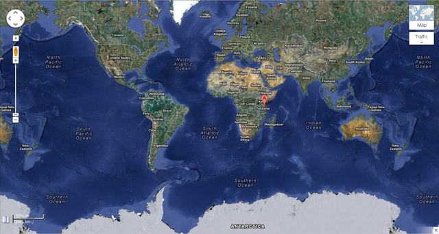 RX in Tanzania with TX in South America with refraction point over mid-South Atlantic?
Or TX in Indonesia with refraction above the Indian Ocean?
Due to quirks in the geomagnetic fields, there are equatorial "anomalies" in the ionosphere layer. The F2 layer - the ionosphere region with the highest electron density - is not uniform about the equator.
In the plot below, note over South America the 'dip' in the F2 layer peak to below the equator. And over west Africa, note the hump above. Quirks which need to be accommodated when selecting and establishing a TX site for skywave propagation.
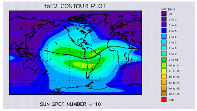 Ionospheric anomalies
As an aside, there is no technical reason - other than issues of climate, remoteness (and politics) - to prevent the use of Antarctica for skywave transmission. Offering valuable azimuth angles for reception across all continents, the polar continent may be extremely important for skywave transmitter sites. Does that function partly explain the territorial claims for the land - the so-called War for Antarctica? And during Antarctic exploration expeditions, does research into skywave propagation form part of the work undertaken?
EDIT: For the foF2 anomaly plot, see:
http://www.gmat.unsw.edu.au/snap/gps/cl ... onbend.pdf


